ENVIRONMENT CANADA
*************************
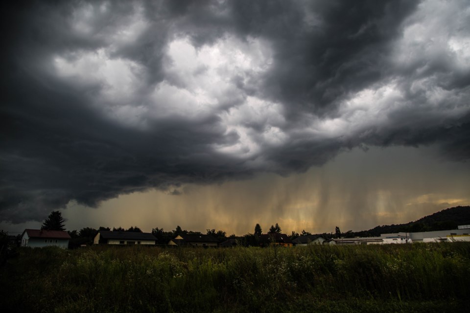
Severe thunderstorm warning in effect for:
- Barrie - Collingwood - Hillsdale
At 11 a.m. EDT, Environment Canada meteorologists are tracking a line of severe thunderstorms capable of producing very strong wind gusts and heavy rain.
This line of severe thunderstorms is located from north of Collingwood to near Hanover, moving east at 60 km/h.
Hazard: 90 km/h wind gusts.
Locations impacted include:
Mount Forest, Barrie, Hanover, Durham, Arthur, Dundalk, Grand Valley, Collingwood and Shelburne.
Take cover immediately, if threatening weather approaches. Heavy downpours can cause flash floods and water pooling on roads. Strong wind gusts can toss loose objects, damage weak buildings, break branches off trees and overturn large vehicles. Remember, severe thunderstorms can produce tornadoes.
Severe thunderstorm warnings are issued when imminent or occurring thunderstorms are likely to produce or are producing one or more of the following: large hail, damaging winds, torrential rainfall.
The Office of the Fire Marshal and Emergency Management recommends that you take cover immediately if threatening weather approaches.
Please continue to monitor alerts and forecasts issued by Environment Canada. To report severe weather, send an email to [email protected] or tweet reports using #ONStorm.
For more information: http://www.emergencymanagementontario.ca/english/beprepared/beprepared.html.
Severe thunderstorm warning in effect for:
- Midland - Coldwater - Orr Lake
- Orillia - Lagoon City - Washago
At 10:52 a.m. EDT, Environment Canada meteorologists are tracking a severe thunderstorm capable of producing very strong wind gusts and heavy rain.
This line of severe thunderstorms is located from near Killbear Park to Owen Sound, moving east at 70 km/h.
Hazard: 120 km/h wind gusts in some locations.
Locations impacted include:
Parry Sound, Midland, Gravenhurst, Bracebridge, Huntsville, The Massasauga Provincial Park, Wasaga Beach Provincial Park, Wasaga Beach, Awenda Provincial Park, Oastler Lake Provincial Park, Penetanguishene, McKellar, Georgian Bay Islands National Park, Elmvale, Dunchurch, Port McNicoll, MacTier, Springwater Provincial Park, Hillsdale and Six Mile Lake Provincial Park.
Take cover immediately, if threatening weather approaches. Heavy downpours are likely to cause flash floods and water pooling on roads. Remember, severe thunderstorms can produce tornadoes.
Severe thunderstorm warnings are issued when imminent or occurring thunderstorms are likely to produce or are producing one or more of the following: large hail, damaging winds, torrential rainfall.
The Office of the Fire Marshal and Emergency Management recommends that you take cover immediately if threatening weather approaches.
Please continue to monitor alerts and forecasts issued by Environment Canada. To report severe weather, send an email to [email protected] or tweet reports using #ONStorm.
For more information: http://www.emergencymanagementontario.ca/english/beprepared/beprepared.html.
Heat Warning in effect for:
- Barrie - Collingwood - Hillsdale
- Orillia - Lagoon City - Washago
A hot and humid air mass will affect south-central Ontario and the Greater Toronto Area today. Slightly cooler and less humid conditions may arrive on Monday.
Daytime high temperatures: 31 to 34 degrees Celsius
Overnight low temperatures: 20 to 24 degrees Celsius
Humidex values: low 40s today
Hot and humid air can also bring deteriorating air quality and can result in the Air Quality Health Index approaching the high-risk category.
Watch for the effects of heat illness: swelling, rash, cramps, fainting, heat exhaustion, heatstroke and the worsening of some health conditions.
Never leave people or pets inside a parked vehicle.
When it's hot eat cool, light meals.
Outdoor workers should take regularly scheduled breaks in a cool place.
Heat warnings are issued when very high temperature or humidity conditions are expected to pose an elevated risk of heat illnesses, such as heat stroke or heat exhaustion.
Please continue to monitor alerts and forecasts issued by Environment Canada. To report severe weather, send an email to [email protected] or tweet reports using #ONStorm.
*************************


