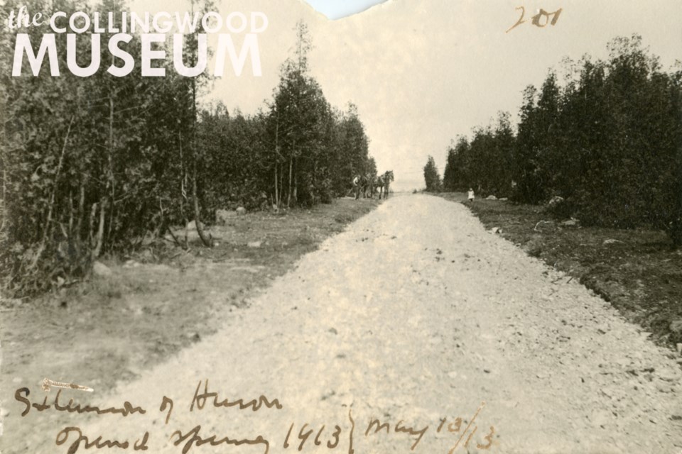
Today’s featured photograph shows the eastern extension of Huron Street, recorded by the Huron Institute to have opened in the Spring of 1913. Taken on May 13, 1913, this picture shows the many cedar trees that defined Collingwood’s early waterfront. Some of these can still be found at Sunset Point.
The road extension looks a bit rough by today’s standards. Upon closer inspection, a man and team of horses are visible along the road’s left side. A levelling implement appears to be attached to the horses, so it’s possible the photographer was documenting the road work as it was in progress or just being finished.
The exact location of this photograph is unknown as Huron Street has changed quite significantly since Collingwood’s incorporation in 1858. Originally, Huron Street was interrupted by Georgian Bay’s waterline.
The 1875 Bird’s Eye View Map of Collingwood (Photograph 2) provides an exceptional visualization of the early waterfront and reveals the reasoning behind Rodney Street’s diagonal cut between Huron and Simcoe Streets. This cropped section of the map features some of Collingwood’s early buildings and industries, including the historic Northern Railway property between Minnesota and St. Paul Streets.
If you have any information to share about today’s featured photograph, please contact Collingwood Museum staff at [email protected].
Huron Institute 201; Collingwood Museum Collection X970.798.1
Remember This is a weekly series of historic photographs submitted by the Collingwood Museum to CollingwoodToday.ca. These photographs were originally collected and documented by the Huron Institute in an historical catalogue entitled Huron Institute Paper and Records: Volume III. Much of Collingwood’s early history has been preserved due to the dedication and foresight of the early museum’s founders, namely its secretary-curator David Williams, upon its establishment in 1904.


